Skip to content
Industry Drones UK
Menu
  • About
  • News
  • Contact

Category: Photogrammetry

Confined Space / Culvert Mapping / lidar / Photogrammetry

Enhancing Workforce Safety with Elios 3: Collecting Data in Confined Spaces

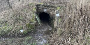
Introduction:In today’s industrial landscape, ensuring the safety of workers is of paramount importance. Many industries involve working in confined spaces, which pose significant risks to the workforce. However, with the …

Confined Space / Culvert Mapping / Photogrammetry

Exploring the Revolutionary Elios 3 Drone: A Game-Changer in Industrial Inspections

Introduction:In recent years, the field of industrial inspections has witnessed a remarkable transformation with the advent of advanced drone technology. Among the cutting-edge drones available today, the Elios 3 stands …

digital terrain model / lidar / Photogrammetry

Mastering Drone Mapping: Unleashing the Power of Ground Control

Ground control is vital for photogrammetry because it provides accurate and reliable reference points in the real world that can be used to accurately measure and reconstruct the 3D geometry …

Recent Posts

  • Revolutionising Historic Building Surveying with Drone Technology
  • Revolutionising Tank Inspections with Flyability Elios 3 and Industry-Drones
  • Enhancing Workforce Safety with Elios 3: Collecting Data in Confined Spaces
  • Exploring the Revolutionary Elios 3 Drone: A Game-Changer in Industrial Inspections
  • Mastering Drone Mapping: Unleashing the Power of Ground Control

Recent Comments

    Archives

    • November 2023
    • January 2023

    Categories

    • Confined Space
    • Culvert Mapping
    • digital terrain model
    • lidar
    • Photogrammetry
    • Uncategorized

    Meta

    • Log in
    • Entries feed
    • Comments feed
    • WordPress.org
    Join our Newsletter
    Keep Updated
    Copyright © 2025 Industry Drones UK – OnePress theme by FameThemes